3/22/09 Exploring the Creek
Posted: Tue Mar 24, 2009 9:35 am
On Sunday I didn't really give much thought to getting back to Big Rock Creek where I was the day before and found a stretch of the creek I like to fish devastated by the recent flooding. I was content at cleaning up the yard, burning off the last of the leaves left over from the year before and finishing it off cooking out on the grill. By then it was barely 4 o'clock. My wife was tired, battling the last of pneumonia and whatever else was running through her system and she was going to lay down.
"You're not going to keep your wife company?" I was asked.
"Why, so I can watch you sleep. I'm going to take pictures."
"You're going fishing too, aren't you."
"Well, duh. I'm going to be in water."
I threw some things in the car and went back to where I left off on Saturday. Got all suited up in my waders and went to put on my fishing vest. It wasn't in the car. Yesterday I forgot the camera, today my fishing tackle. On my rod was one jig and twister. On the back seat of my car was a bag with a half dozen twisters in it. It would have to do. I wasn't planning on fishing the creek anyway, I had already proved there weren't any fish in it on Saturday. I was here to document the flood damage. I had a few photographs that I had taken in the past whose locations I had pretty much memorized. I have that kind of odd visual memory, and I wanted to get to those same spots and take a picture to see how they compare.
This first shot is what you see when you drop down to creek level from the bridge. If you know this area, you know right off that something is just not right. Everything just looks mowed down.
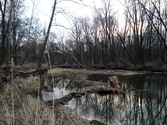
On the first gravel bar you can see how everything was scoured down to the rocks. The near shore looks completely different from normal. The far side has trees littering the shore. These were not here a year ago.
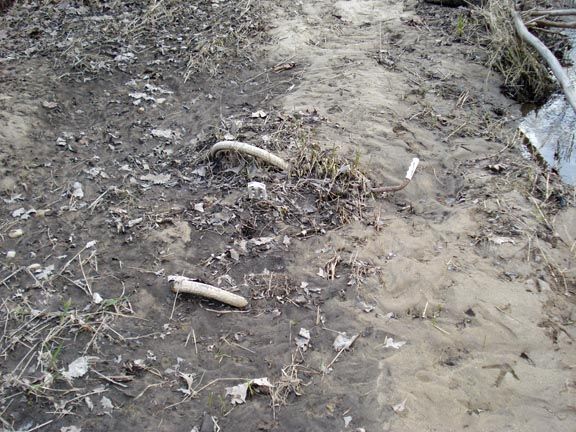
I came across this bike emerging from the sand bed. I've walked this stretch dozens of times before and have never seen any trace of it before.
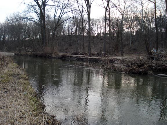
Usually that rock slopes into the creek. This is what I wrote about it yesterday:
I was going to walk along in the water like I always did in this stretch, but I was now standing 1 to 2 feet above the water with a pretty much straight drop to it. The rock here used to slope to the creek and I would walk along in ankle to calf deep water. Not anymore. The shore had been scoured away. Dropping down into the water would have now put me into almost 3 feet of it. That is a tremendous amount of rock that had been moved.
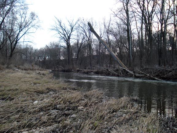
I came across this tree leaning down stream. All around it everything else, including smaller trees, had been snapped off and scoured down to the ground. You could see on this tree that something big and heavy had rolled over it, scraping off most of the bark on this side.
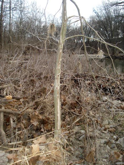
This mess was sitting 20 feet beyond the bark less tree. It's about 18 inches thick and sitting on top of another tree. You can see that other trees root ball in the background to the right. If you look at the tree on the left you'll see bare marks. I thought this might be from a beaver. Turns out it was where a tree must have jammed up against it and kept rubbing against the tree.
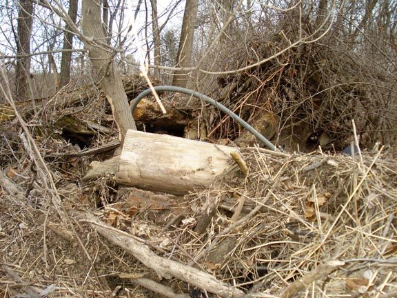
This is what I wrote about this stretch on Saturday:
The opposite shore, usually an impenetrable tangle of undergrowth and trees, had big holes punched through it. The shore line being eaten away didn't surprise me. That side was primarily dirt and would relatively easily wash away.
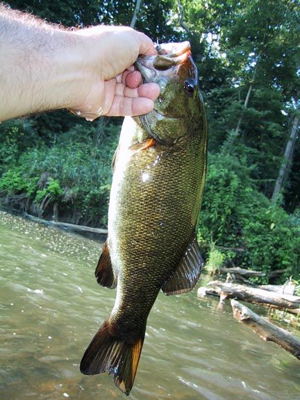
This next picture really isn't about catching 16 inch smallies out of a small creek, but about the 5 foot deep scour hole that these 16 inch smallies live in. You can start to see that scour hole in the background behind the fish.
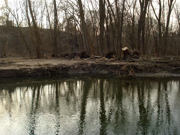
This is what that shore looks like now. This is where all that rock that had been torn out of the creek bed wound up. Or so I thought. The highest point of all that rock is about 2 feet above the water and almost 100 feet long. What I find amazing is that in order to look like this, it first had to fill that 5 foot deep scour hole and all the deeper water around it.
I have seen numerous stream bank stabilization projects. They always seem kind of, well, lame. In this case it's almost as if mother nature came in and said, "Look, I'm just going to show you this once. This is how you do a stream bank stabilization project."
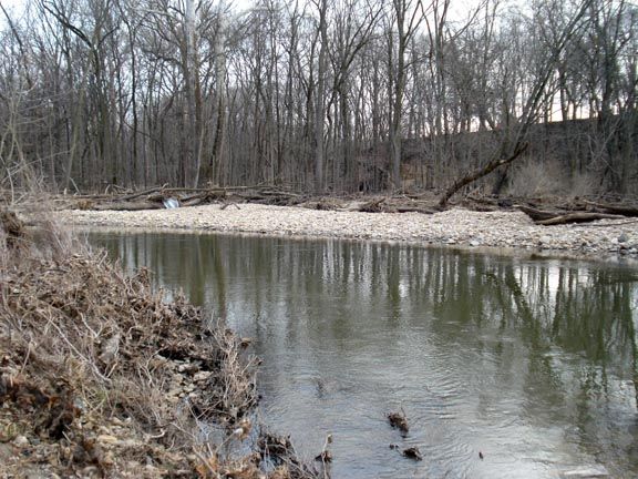
The far end of the new rock shore line now looks like this.
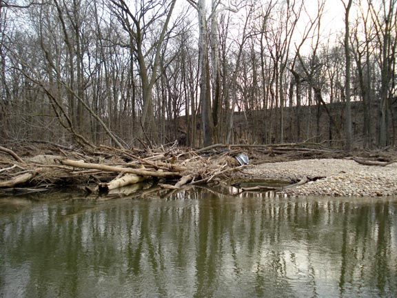
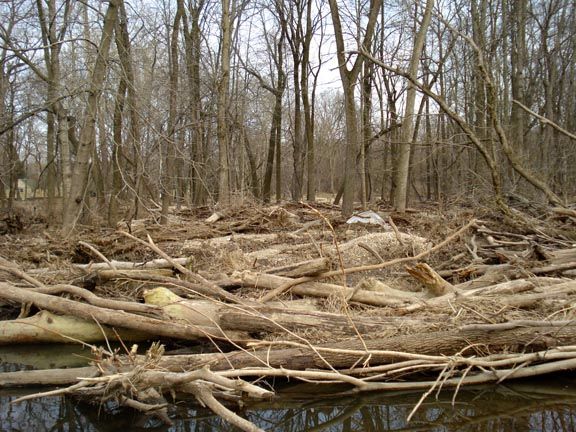
I got across the creek and took a closer look at the tangle of trees.
And the expanse of rock.
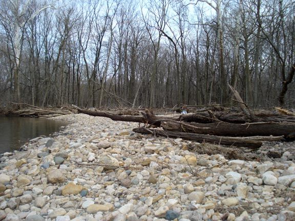
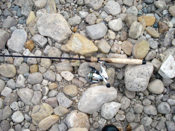
I laid my rod down on the ground to get a sense of scale for the size of the rocks that were being pushed around. This spot is about 18 inches above the water and I believe it is directly over what was the 5 foot deep scour hole.
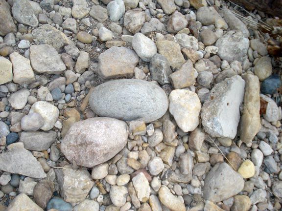
This stretch is a rock collectors dream come true. I don't know my rocks, but in this one shot there are two different kinds of granite. One kind of pink and another a green/blue, quartz, worn down limestone, worn down concrete and when I took this picture I didn't even notice that blue rock off to the right. Saw all kinds of beautiful shapes and sizes.
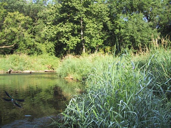
These next two shots I took in June of 2008. They're taken from just around the bend look back west. Notice the damsel fly in the lower left corner of the first one. Kind of cool looking. Amazing what you see in the pictures once you get to look at them again.
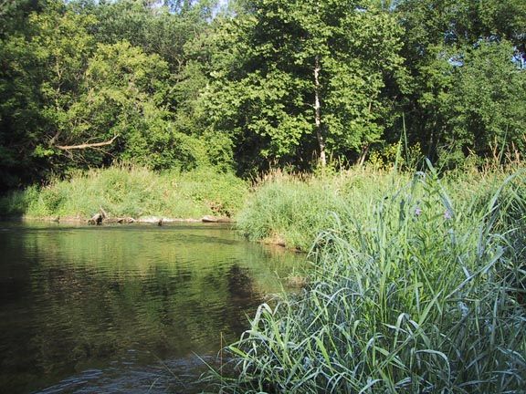
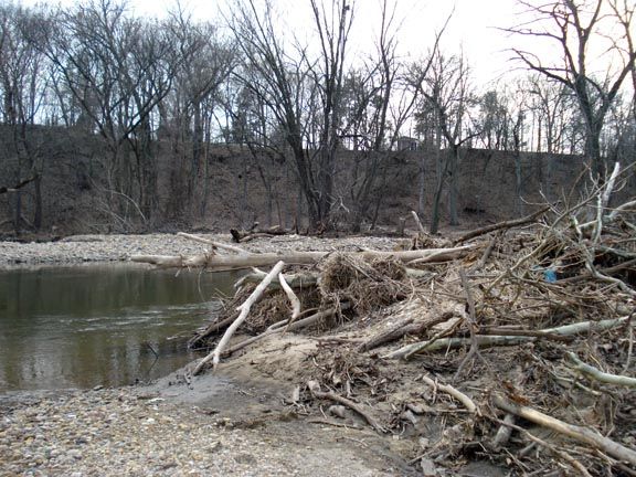
This was taken from almost the same point. You can tell that the channel of the creek has changed. I'm going to try to get back there in June of this year and document all this again. Will be interesting to see if all this green returns.
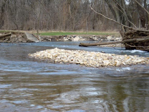
This is brand new and sitting in the middle of the creek just before it turns south again. It's forcing the creek onto either side of it and making the overall creek wider.
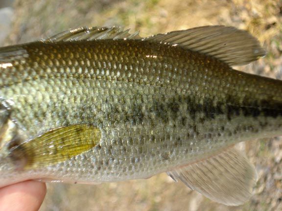
Standing up on the bank and looking through the trees further down stream, I could see piles of new rock much further down. But I just didn't have the energy to fight the creek or climb over all the piled up debris in order to do more exploring. So I headed back, crossed the creek and stopped to fish the pond. I did have my fishing pole with me you know so I had to put it to use. Caught a couple of largemouth and snapped this last picture.
I don't care if its only about 10 inches long. When you get up close and personal like this, they're still stunningly beautiful.
"You're not going to keep your wife company?" I was asked.
"Why, so I can watch you sleep. I'm going to take pictures."
"You're going fishing too, aren't you."
"Well, duh. I'm going to be in water."
I threw some things in the car and went back to where I left off on Saturday. Got all suited up in my waders and went to put on my fishing vest. It wasn't in the car. Yesterday I forgot the camera, today my fishing tackle. On my rod was one jig and twister. On the back seat of my car was a bag with a half dozen twisters in it. It would have to do. I wasn't planning on fishing the creek anyway, I had already proved there weren't any fish in it on Saturday. I was here to document the flood damage. I had a few photographs that I had taken in the past whose locations I had pretty much memorized. I have that kind of odd visual memory, and I wanted to get to those same spots and take a picture to see how they compare.
This first shot is what you see when you drop down to creek level from the bridge. If you know this area, you know right off that something is just not right. Everything just looks mowed down.
On the first gravel bar you can see how everything was scoured down to the rocks. The near shore looks completely different from normal. The far side has trees littering the shore. These were not here a year ago.
I came across this bike emerging from the sand bed. I've walked this stretch dozens of times before and have never seen any trace of it before.
Usually that rock slopes into the creek. This is what I wrote about it yesterday:
I was going to walk along in the water like I always did in this stretch, but I was now standing 1 to 2 feet above the water with a pretty much straight drop to it. The rock here used to slope to the creek and I would walk along in ankle to calf deep water. Not anymore. The shore had been scoured away. Dropping down into the water would have now put me into almost 3 feet of it. That is a tremendous amount of rock that had been moved.
I came across this tree leaning down stream. All around it everything else, including smaller trees, had been snapped off and scoured down to the ground. You could see on this tree that something big and heavy had rolled over it, scraping off most of the bark on this side.
This mess was sitting 20 feet beyond the bark less tree. It's about 18 inches thick and sitting on top of another tree. You can see that other trees root ball in the background to the right. If you look at the tree on the left you'll see bare marks. I thought this might be from a beaver. Turns out it was where a tree must have jammed up against it and kept rubbing against the tree.
This is what I wrote about this stretch on Saturday:
The opposite shore, usually an impenetrable tangle of undergrowth and trees, had big holes punched through it. The shore line being eaten away didn't surprise me. That side was primarily dirt and would relatively easily wash away.
This next picture really isn't about catching 16 inch smallies out of a small creek, but about the 5 foot deep scour hole that these 16 inch smallies live in. You can start to see that scour hole in the background behind the fish.
This is what that shore looks like now. This is where all that rock that had been torn out of the creek bed wound up. Or so I thought. The highest point of all that rock is about 2 feet above the water and almost 100 feet long. What I find amazing is that in order to look like this, it first had to fill that 5 foot deep scour hole and all the deeper water around it.
I have seen numerous stream bank stabilization projects. They always seem kind of, well, lame. In this case it's almost as if mother nature came in and said, "Look, I'm just going to show you this once. This is how you do a stream bank stabilization project."
The far end of the new rock shore line now looks like this.
I got across the creek and took a closer look at the tangle of trees.
And the expanse of rock.
I laid my rod down on the ground to get a sense of scale for the size of the rocks that were being pushed around. This spot is about 18 inches above the water and I believe it is directly over what was the 5 foot deep scour hole.
This stretch is a rock collectors dream come true. I don't know my rocks, but in this one shot there are two different kinds of granite. One kind of pink and another a green/blue, quartz, worn down limestone, worn down concrete and when I took this picture I didn't even notice that blue rock off to the right. Saw all kinds of beautiful shapes and sizes.
These next two shots I took in June of 2008. They're taken from just around the bend look back west. Notice the damsel fly in the lower left corner of the first one. Kind of cool looking. Amazing what you see in the pictures once you get to look at them again.
This was taken from almost the same point. You can tell that the channel of the creek has changed. I'm going to try to get back there in June of this year and document all this again. Will be interesting to see if all this green returns.
This is brand new and sitting in the middle of the creek just before it turns south again. It's forcing the creek onto either side of it and making the overall creek wider.
Standing up on the bank and looking through the trees further down stream, I could see piles of new rock much further down. But I just didn't have the energy to fight the creek or climb over all the piled up debris in order to do more exploring. So I headed back, crossed the creek and stopped to fish the pond. I did have my fishing pole with me you know so I had to put it to use. Caught a couple of largemouth and snapped this last picture.
I don't care if its only about 10 inches long. When you get up close and personal like this, they're still stunningly beautiful.