Fox River Fishing Maps
Posted: Thu Mar 11, 2010 11:50 pm
In 1989 a friend gave me a copy of Ed Mullady's Kankakee River maps. I loved the whole look of them with their hand drawn details and profiles of the types of fish you can catch out of specific spots on that river. I didn't fish much back then, went to the Kank once, didn't catch anything and didn't go back for almost 10 years. In 1996 I fished the Fox River for the first time and river fishing became an obsession. I looked around for the equivalent type of maps for the Fox River and they didn't exist. So I decided to fish the river a lot and make my own.
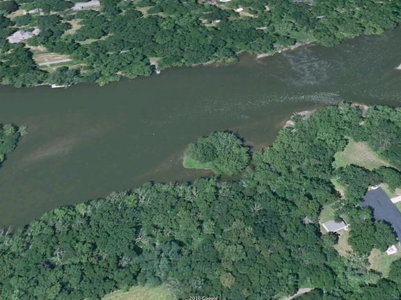
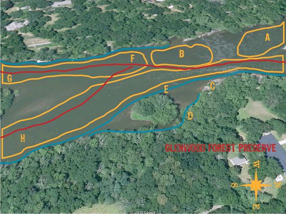
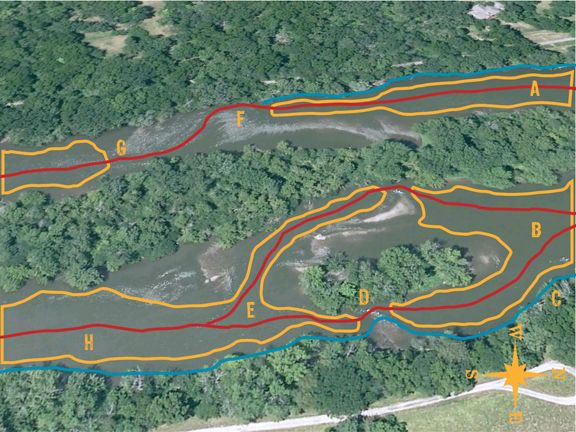
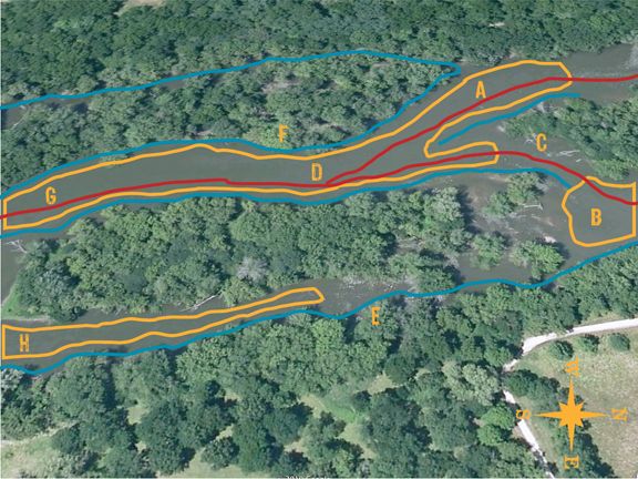
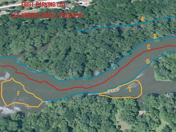
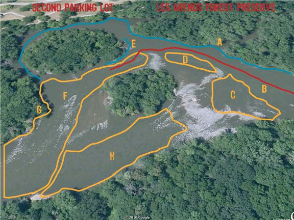
Let me know if you can make out these maps okay. On my screen everything is pretty clear and readable.
About 12 years ago, after about 2 years of fishing the Fox, I started collecting maps of the whole river system. Back then there was only one booklet available with detailed maps, but the guy only concentrated on the dams. Which I don't fish. I knew right off they were outdated even then when he had a lot of markings for pike, which are virtually non-existent in the areas he said they were in. And, one point in North Aurora was marked as a good spot for pike that was in ankle deep water. Oh kay.
In 1999 I started downloading and piecing together black and white aerial photo's. There was only black and white back then. I have the whole river pieced together from Elgin to Millhurst. I also collected all of the topo maps for pretty much the whole river. The plan was to do a hybrid map consisting of the aerials, topo maps and hand drawn details from my fishing trips. I have a whole magazine style layout of a few sections done.
This initial map book was done in 2002. It was quick and dirty, but served the purpose at the time. I never took it any further because I wanted things in color.
First Version of Fox River Fishing Maps
With the slow computers back then, the whole thing turned into a time consuming venture. It was cutting into my fishing time. So I shelved it somewhere in the back of my head and continued on with the research. Can't mark maps if I don't cover as much river as possible. My peak year of fishing in general was I think 2003, when not only did I fish just over 250 days out of the year, but about 150 of those were on the Fox.
A few years ago I did the same thing again with the aerial photos only this time in color. I concentrated on the stretch from Geneva down to around Millbrook, the areas I fish the most and like the most. Got them all together and started a new magazine style layout.
Still not good enough.
The speed of the computers are now up there and the quality of aerial photos are much better. Now things are close to what I started to picture in my head almost 12 years ago. Still not quite what I picture, but it might be close enough.
The problem now is that the best maps of the Fox, birds eye views that you can get from Bing maps, were all shot when the river was at flood stage. Totally useless. You can't see any of the current breaks and rock bars. The whole river looks like one big flat piece of water. Which it's not. So, on Google Earth you can get kind of a hybrid birds eye view. Not what I had in mind, but you can see all the details of the river that are important to key in on. I'll have to wait for the next version of birds eye views and hope they shoot them at low water. New ones come up every few years. I should have these done by then.
I can do this kind of detailed information for the wadeable sections of the Fox from the Geneva dam all the way to the Yorkville dam. Obviously that leaves out the areas that start turning into the pools above the dams. From some canoe trips I've taken, I can even detail at least one worth while stretch that most will never see. I also can do this for quite a few miles of the river below Yorkville. This year I hope to add a couple of more miles to my mental collection. We'll see.
I have a lot of the details worked out in my head. They're extensive. I have this pictured as both a book and an interactive piece. I work in the print world. That one is easy for me. The other is a challenge, but not impossible.
So, let me know what else might be worth adding to the aerials without them getting too cluttered. I already realized I need to add a compass rose. Each line and shape have corresponding letters. Each one of these would be expanded on with details on how to fish them and what to expect, keyed to the letters. Somewhere in my collection I have stories that almost cover all of the river. Plus hundreds of photos. Those too would be incorporated some how.
Now I need a good two years full time to complete it. More research to cover the few hundred yards I haven't waded in that long stretch and more photos to go take. Then on the the miserable days where it's not worth being out, which is most of winter and some just butt ugly days, sit and hack out the words needed for each section.
And when that's done, start on the Book of Fox Creeks.